

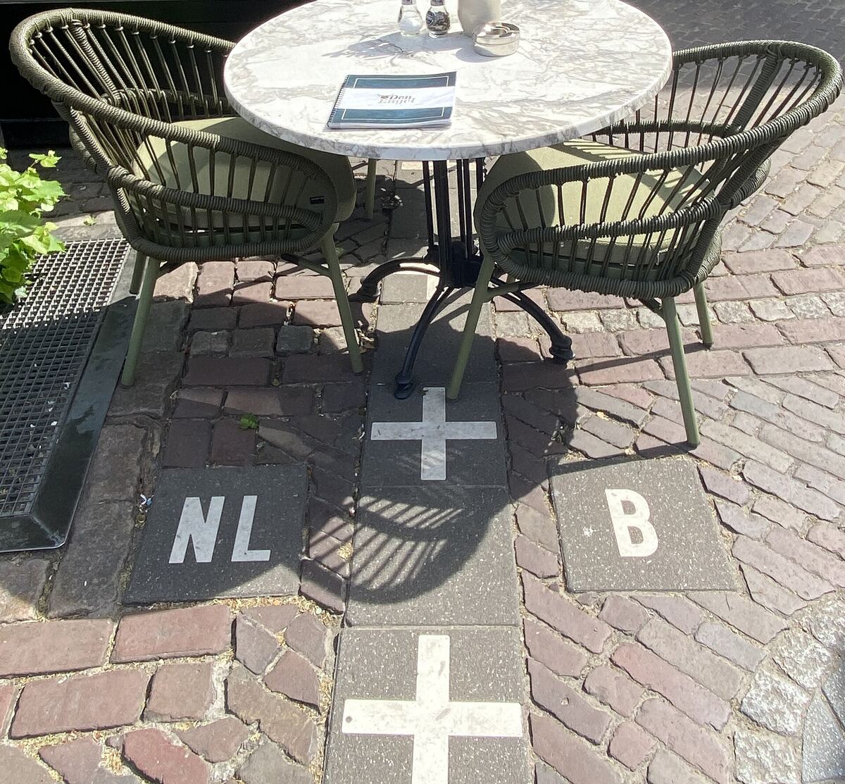
Somewhere in the middle of a small, tidy town on the Dutch–Belgian frontier, there is a café table on a cobbled pavement. Two chairs. A vase of flowers. A menu. And running underneath it, marked in white crosses set into the stones, the international border between Belgium and the Netherlands. 🗺️
Sit on one chair and you are in the Kingdom of the Netherlands. Sit on the other and you are in the Kingdom of Belgium. Put your coffee down in the middle and it is, briefly, a diplomatic matter. Nobody minds. Somebody will come and take your order.
One town, two countries, roughly thirty pieces
The town is Baarle, and it is two towns wearing one coat. The Dutch municipality is Baarle-Nassau, in North Brabant. The Belgian municipality is Baarle-Hertog, in Antwerp province. They are not side by side, the way a sensible border town would be. They are interleaved — scattered through one another like a dropped jigsaw.
The technical word is enclave: a piece of one country completely surrounded by another. Baarle has them in bulk, and it also has the rarer trick — counter-enclaves, which are bits of country A inside a bit of country B inside country A. Dutch land inside Belgian land inside the Netherlands.
Here is where it gets pleasantly slippery: the count depends on what you’re counting, and reliable sources disagree in an entirely honest way.
- The two towns’ own tourist office, Visit Baarle, says 30 enclaves — 22 Belgian and 8 Dutch — and cheerfully claims that is “about half of all the enclaves in the world.”
- AFP, reporting from the town for France 24 in June 2024, counted 22 Belgian enclaves and six Dutch counter-enclaves inside them, noting the smallest Belgian one is about the size of half a football pitch.
- Wikipedia, following the detailed 2004 survey of the enclaves by geographer Brendan Whyte, says the municipality of Baarle-Hertog is made of 26 separate parcels of land — of which 22 are the exclaves inside the Netherlands — and that there are seven Dutch counter-enclaves inside Belgian ground, plus an eighth Dutch parcel elsewhere.
All three are right. Twenty-two Belgian pieces is the number everyone agrees on. Whether the Dutch answer is six, seven or eight depends on whether you count only the ones inside the biggest Belgian enclave, all the true counter-enclaves, or every stray Dutch parcel on the list. This is very Baarle: even the total is a matter of administrative taste.
Blame 1198 (politely)
The tangle is genuinely medieval, and it comes from paperwork rather than war.
The tourist office’s own history tells it like this. In 1198, the lord of Breda, Godfried II of Schoten, sided with Henry I, Duke of Brabant, in a dispute over who controlled Breda. He handed Breda to the duke and received it straight back as a fief, and was compensated with a large territory that later became the Barony of Breda — except that the duke kept, parcel by parcel, the land in that area that had already been cleared, farmed and built on.
So the division was never drawn as a line on a map. It was drawn plot by plot, according to what each plot was being used for at the time. Fields here, a farmstead there, a bit of woodland over there. Everywhere else in the region, later centuries eventually tidied this sort of thing away by annexation. In Baarle, nobody ever did — which is why a medieval land inventory is still, in 2026, the reason a shop has two front doors.
The parcels first became international at the Peace of Münster in 1648, when the frontier between the northern and southern Netherlands was drawn through the Duchy of Brabant. When Belgium and the Netherlands formally fixed their border in 1843, the boundary commission looked at Baarle, quietly gave up, and left a gap in the border: boundary post 214 where one municipality ended, post 215 where the next began, and in between, instead of a line, a document listing every single parcel and which municipality it belonged to. That gap was not closed until 1974, and the last enclave boundaries were only promoted to official national borders in 1995 — at which point somebody sensibly numbered them all: H1 to H22 for Hertog, N1 to N8 for Nassau.
The rule of the front door
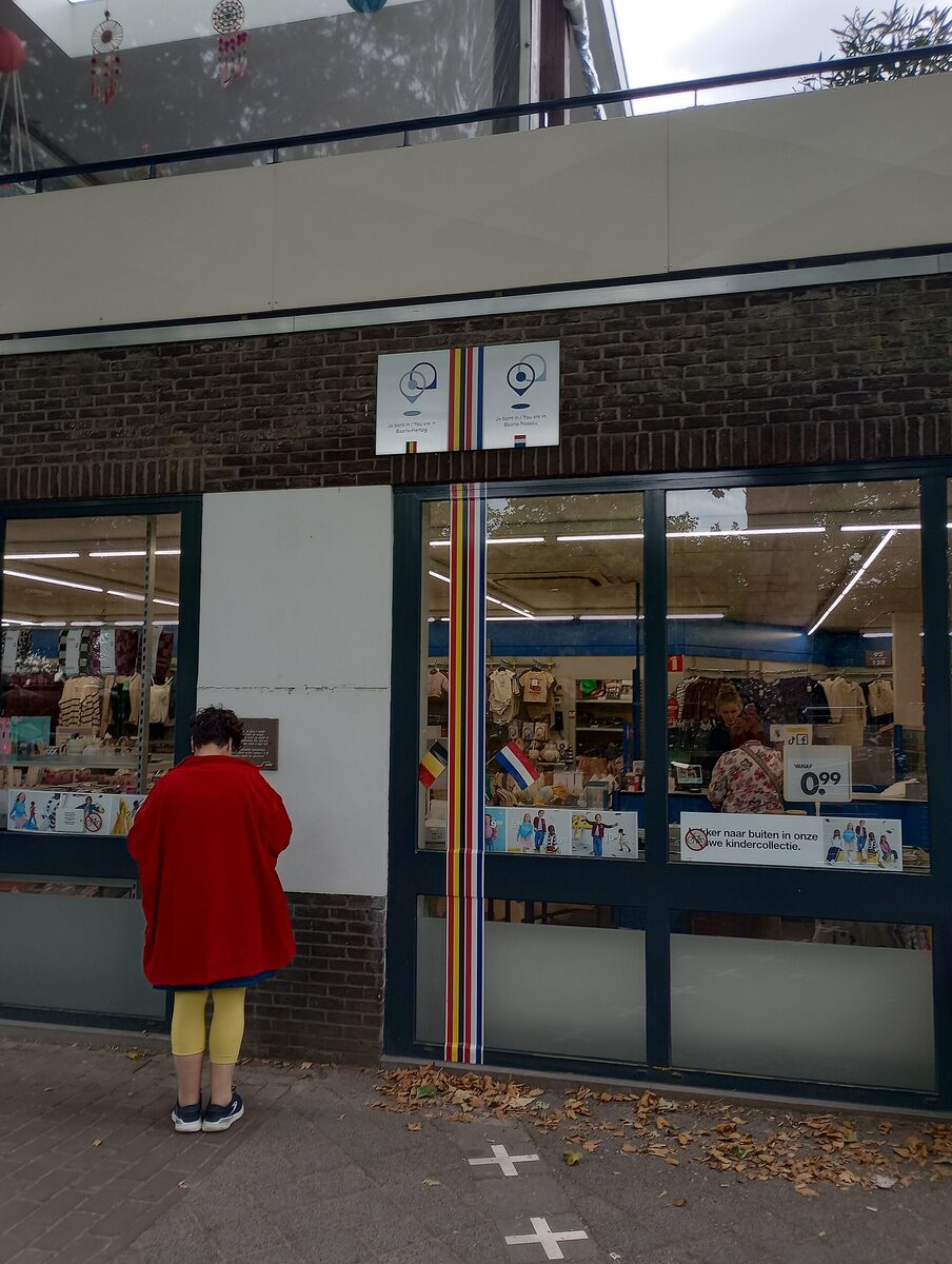
Because the border ignores buildings, buildings need a rule. The rule is the front door.
Which country a house or shop belongs to — its address, its post, its paperwork — follows where its front door stands. Visit Baarle explains the system by way of the house numbers: every number plate in town carries a little national flag in the corner, and that flag tells you which country the front door is standing in. Dutch plates wear the red-white-blue; Belgian plates wear the black-yellow-red. Two neighbours, two flags, one street.
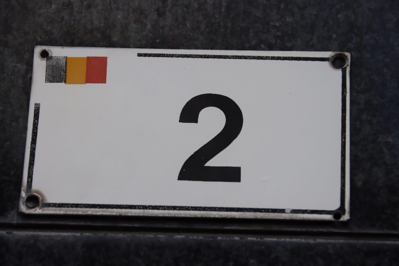
And then there is enclave H7, a Belgian parcel of about a quarter of a hectare, where the boundary does the most Baarle thing imaginable: it runs through the middle of a front door. Whyte’s survey records the consequence with beautiful bureaucratic calm — that one doorway has two house numbers, one for each half. It is Loveren 2, Baarle-Hertog on the Belgian side of the doorframe and Loveren 19, Baarle-Nassau on the Dutch side. Same door. Same doormat. Two countries, two numbers, and presumably two piles of post.
Different countries, different prices, same shop
Two countries in one town means two of nearly everything: two mayors, two municipal councils, two police forces, two fire services. It also means two tax regimes, about four metres apart — and this is where Baarle stops being a curiosity and becomes a shopping strategy.
AFP found the border running straight through a supermarket, past a sign advertising Belgian mayonnaise 25 metres to the left and Dutch chocolate sprinkles 30 metres to the right. Ad Tuijtelaars of the local tourist office gave them the household economics: “Petrol is cheaper in Belgium. Cigarettes are cheaper in Belgium. But food tends to be cheaper in the Netherlands.” Fireworks may only be sold in the Netherlands in the run-up to New Year, but all year round in Belgium — so Dutch shoppers simply walk across the street.
The café version of this is a small local art form. Because the two countries apply different VAT rates, prices for the same cup of coffee aren’t quite the same on the two sides of a terrace, and the geography guide Geodiode reports that some cafés lean into it — labelling menu sections “Belgian side” and “Dutch side,” and siting the main door on whichever side of the line the rules suit best.
Even licensing hours got the treatment. There was a period when Dutch restaurants had to close earlier than Belgian ones; for a restaurant sitting on the border, this simply meant that at closing time the diners moved to a table on the Belgian side and carried on with dinner. Not a dispute. A seating plan.
Nobody is upset about this
You would expect eight centuries of tangled sovereignty to produce, at minimum, an argument. It has produced instead a town that treats the whole thing as a shared local hobby.
The oddities are real and completely ordinary. AFP met a 90-year-old woman living on the Belgian side of a divided house, with her son just down the corridor in the Netherlands. Couples marrying in the town hall choose which country to do it in — left side of the room Belgium, right side the Netherlands. At the 2024 European elections, the Dutch half of town voted on 6 June and the Belgian half had to wait three more days, with two sets of posters for two sets of candidates standing a few paces apart. Visit Baarle notes, without any fuss at all, that in Baarle it is perfectly normal to share a bed and still sleep in two different countries.
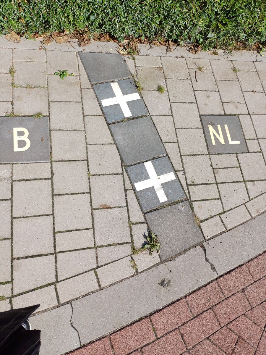
And the town has decided the correct response to all of this is signposting. The border isn’t hidden; it’s picked out in white crosses and lettered tiles so that visitors can find the joke and stand on it. There is even a fingerpost in town pointing to the world’s other enclaves — Llívia, Büsingen, Jungholz, Campione d’Italia, Madha, Dahagram-Angarpota — each arm carrying its country pair and the distance you’d have to travel, like a small municipal wave to the rest of the family.
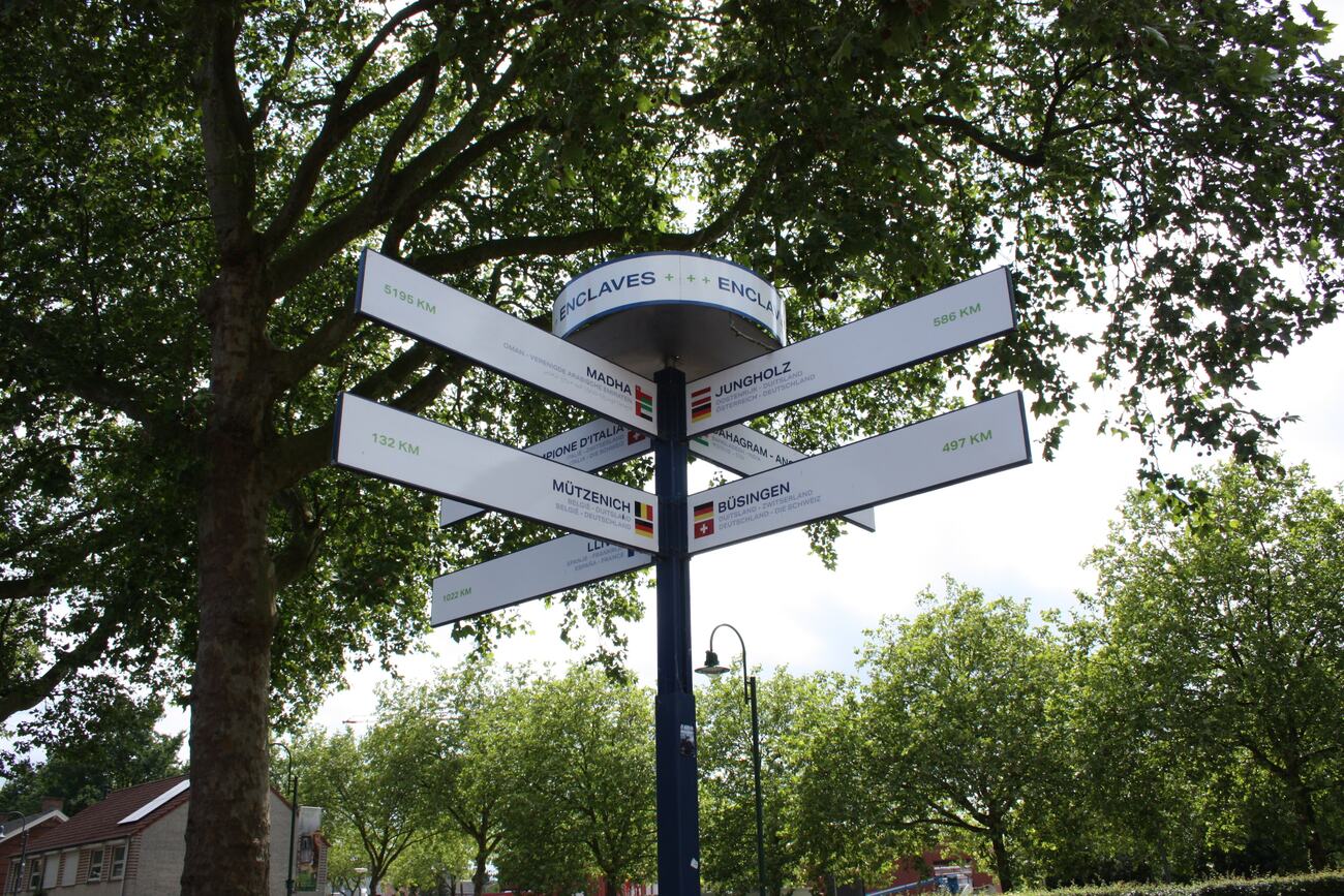
An eight-hundred-year-old administrative accident, never fixed, never resolved, and now maintained on purpose — because the people who live inside it looked at the mess, decided it was charming, and put crosses in the pavement so that the rest of us could come and admire it.
The last word belongs to Tuijtelaars, born and raised in Baarle, who walked through Belgium several times a day on his way to school and thought nothing of it. Asked by AFP how two countries manage to live this tangled up without falling out, he said:
“If you live so close to each other, why should you quarrel? There’s no need for conflict — well, apart from when Belgium plays the Netherlands at football.”


